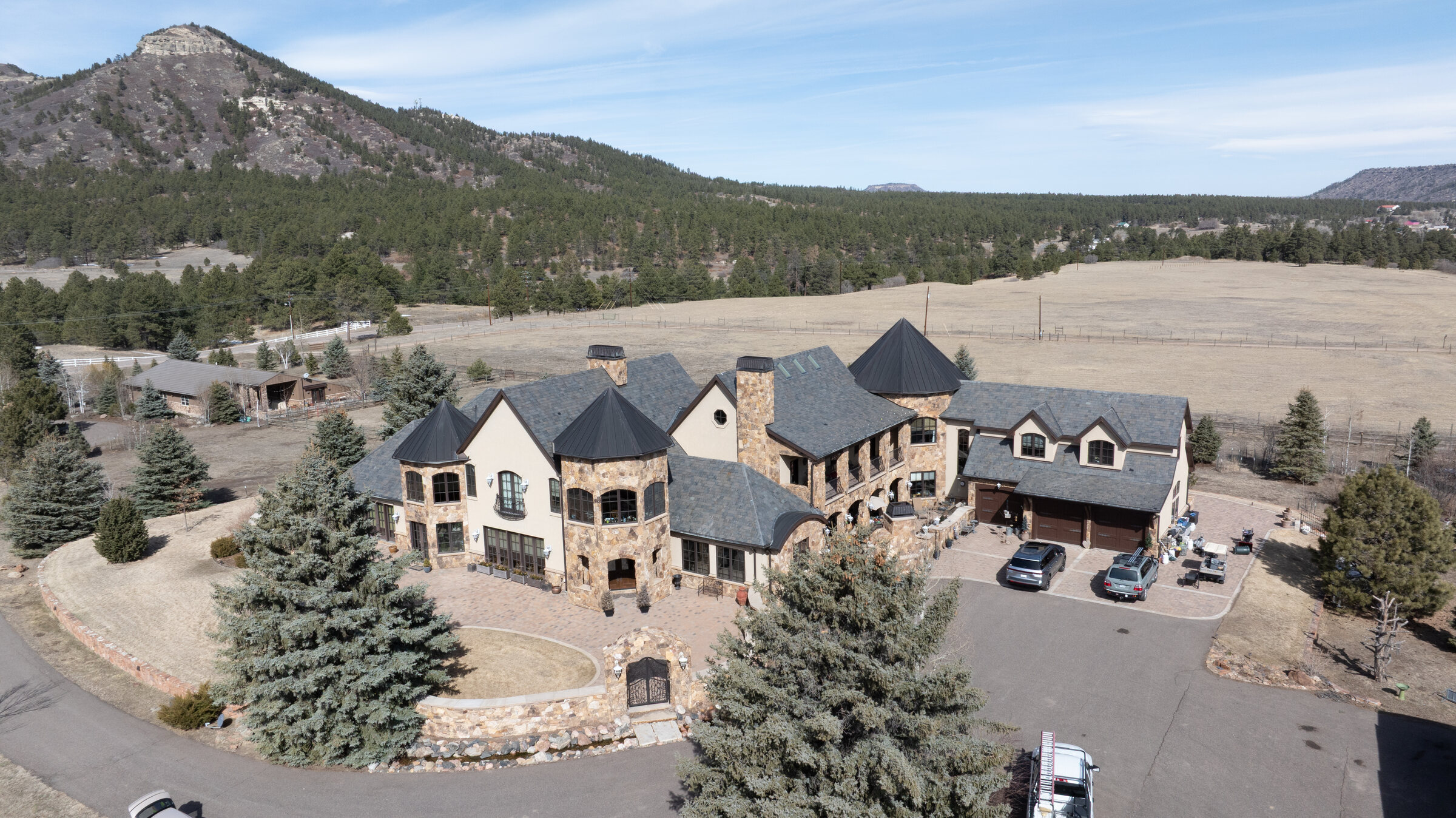
Complex multi-plane estate roof in the Colorado foothills — multiple steep pitches, turrets, and dormers documented without a single ladder
Colorado Springs  ·  FAA Part 107  ·  Same-Day Report

Every square foot.
No one on the roof.

High-resolution aerial documentation for insurance claims, hail damage, pre-sale inspections, and contractor estimates. Annotated PDF report delivered the same day — no ladder, no liability.

FAA Part 107 Certified
$1M Liability Insured
Same-Day Delivery
Veteran-Owned
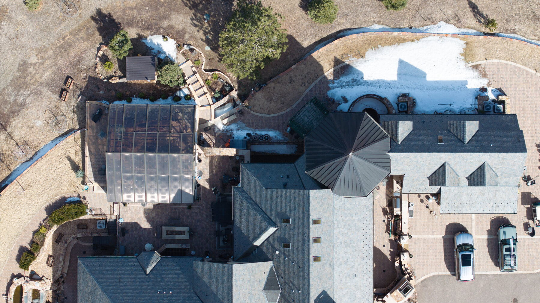
Nadir aerial view of a complex estate roof — multiple planes, standing seam metal turret, solar panels, and skylights documented in a single flight

Colorado roofs take a beating.
We document all of it.

Hail, freeze-thaw cycles, UV exposure at altitude — damage accumulates in places ground-level walkthroughs miss. Ridgelines, valleys, penetrations, flashings, gutters: a drone reaches them all in a single systematic pass and captures what a ladder can't.

You receive a full-resolution image set plus a PDF report with damage annotated by location and type — the same day as the flight. Ready for your insurance adjuster, your roofer, or your buyer's agent without any additional editing on your end.

Every flight is performed by an FAA Part 107 certified remote pilot carrying $1M in liability coverage. Airspace authorizations are handled before we arrive.

Same day
Report delivery
5.0 ★
13 Google reviews
$1M
Liability insured

What you receive
the same day.

01
Full-resolution image set
Every angle of the roof — field, ridge, valleys, penetrations, gutters — captured at high resolution. Organized by roof section for easy reference.
02
Annotated PDF report
Key findings labeled by location and type — granule loss, cracking, lifted flashing, debris accumulation, standing water indicators. Ready to hand directly to an adjuster or contractor.
03
Geotagged photos with timestamps
GPS coordinates and capture timestamps embedded in file metadata. Useful for insurance documentation, dispute records, and future comparison flights.
04
Secure download link
All files delivered via a private link within hours of the flight — no login required, shareable directly with your insurer, roofer, or client.
05
Video walkthrough (on request)
A continuous aerial video of the full roof for clients who want to walk through the footage with their insurer or family before committing to a repair scope.
06
No-access, no-hassle logistics
Nobody needs to be home. We fly with written authorization from the owner or their agent. Vacant listings, occupied rentals, and multi-unit properties are all straightforward.

Actual inspection imagery.

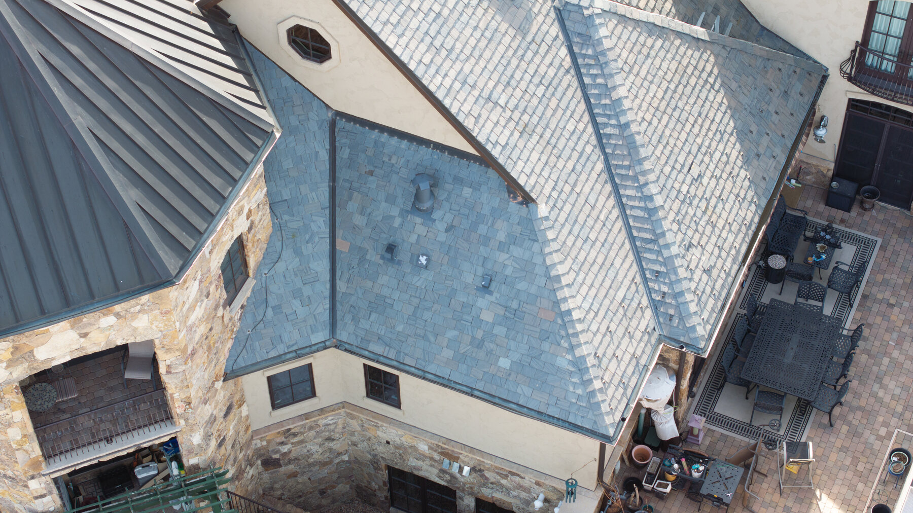
Valley where two steep slate planes meet — pipe penetration, standing seam transition, and skylight flashing all documented in one frame
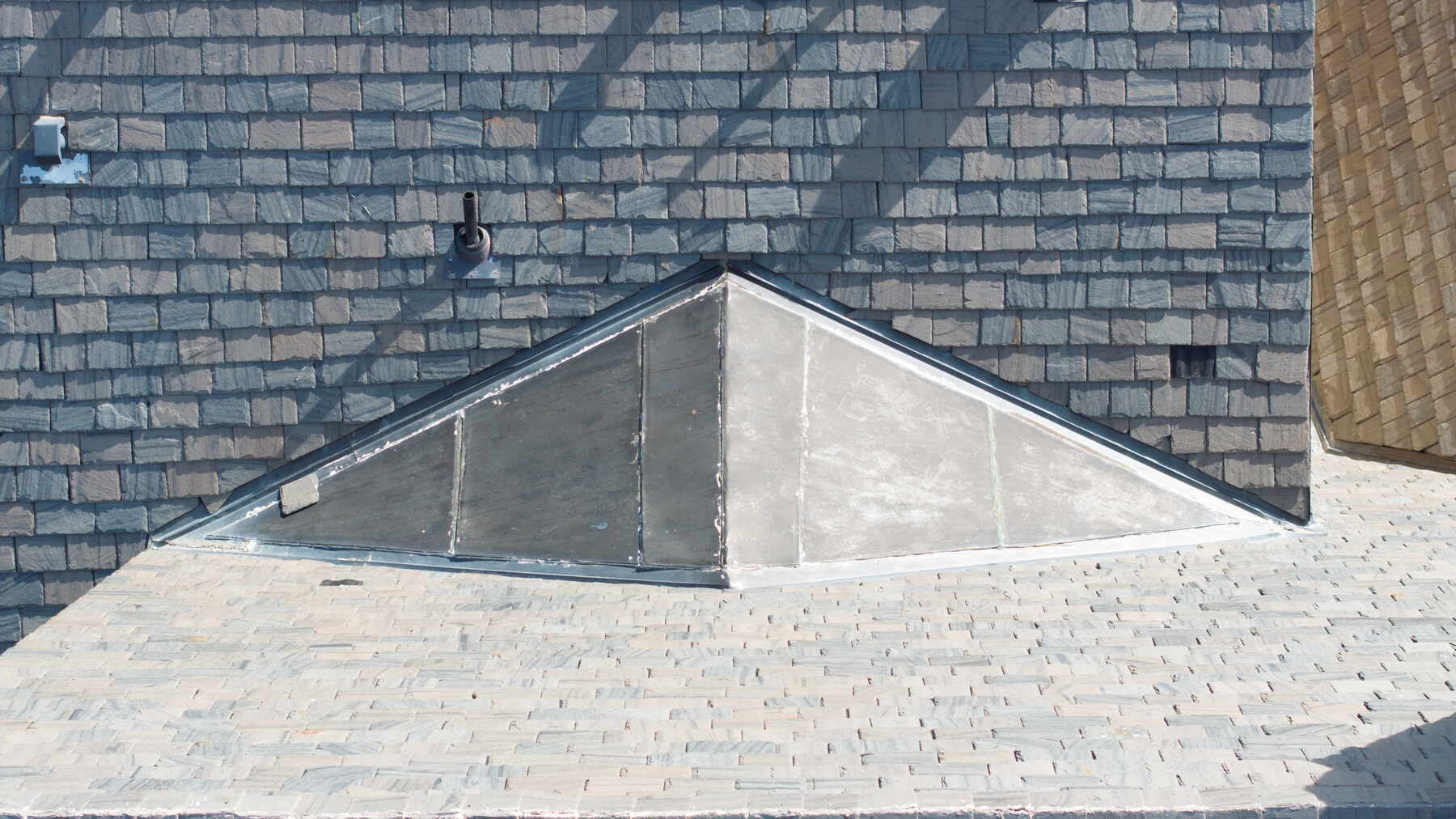
Close-up of slate tile surface condition — individual tiles, skylight flashing, and pipe penetration clearly readable from drone altitude
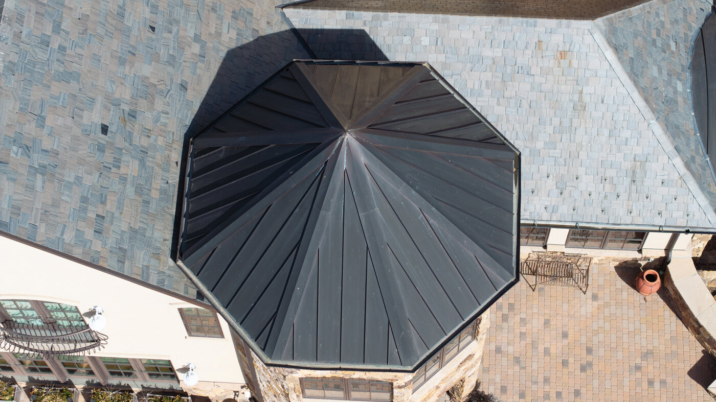
Overhead view of octagonal standing seam metal turret — every seam and the apex clearly readable, impossible to assess from the ground
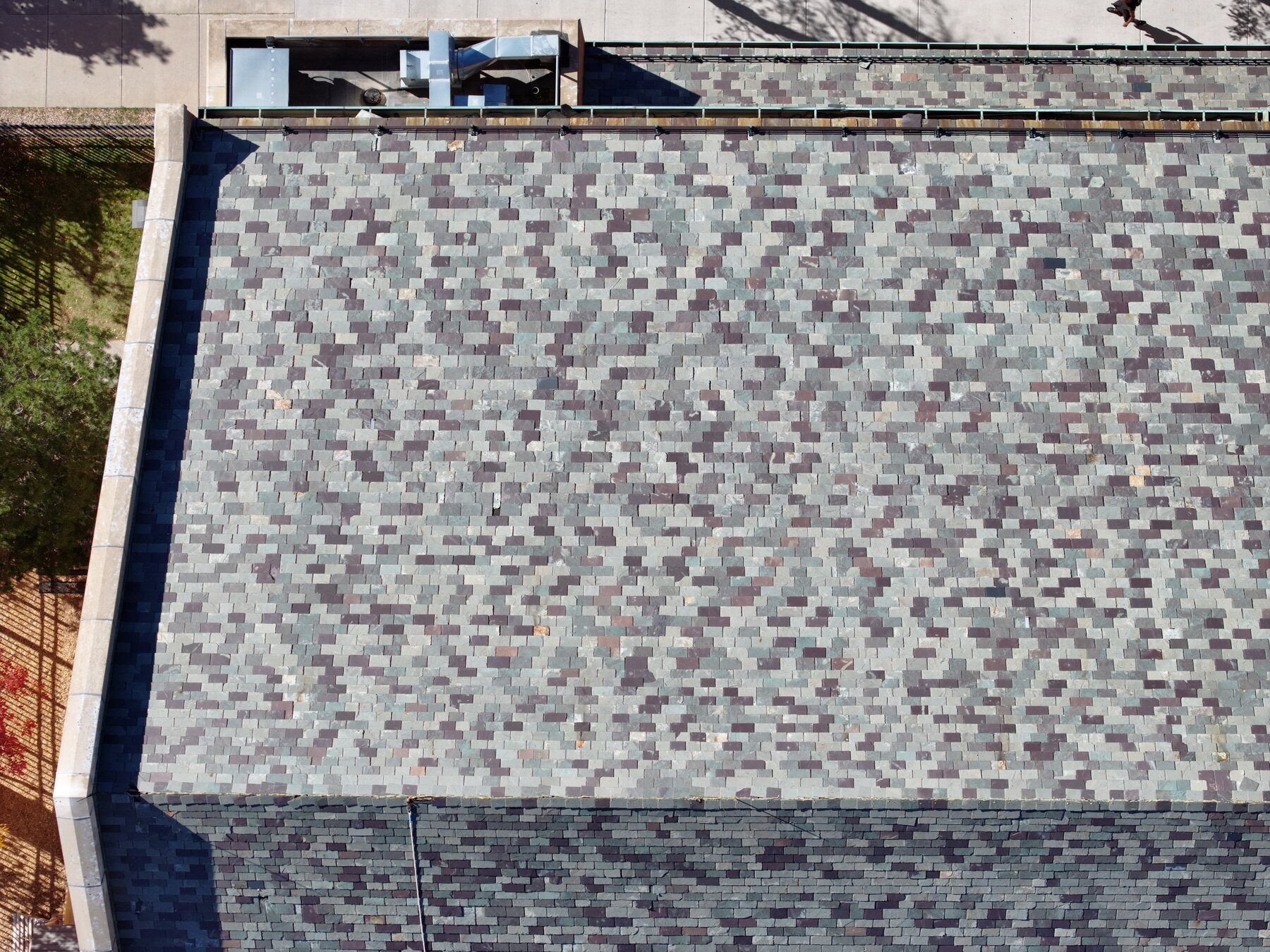
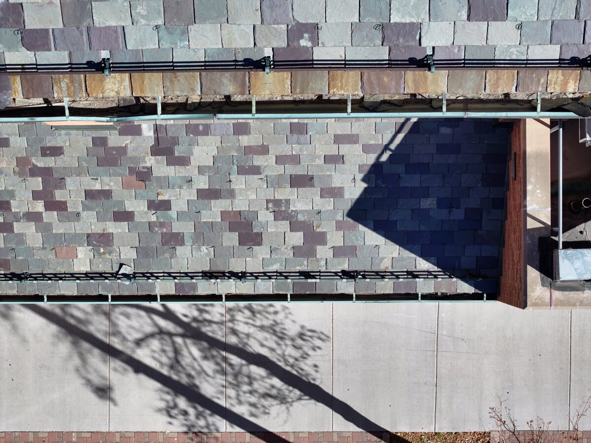
Downtown Colorado Springs shingle field showing color variation, algae staining, and wear patterns — real inspection documentation
Eave and gutter close-up showing deteriorated tile edges and staining — the kind of detail that requires a drone to safely document

Real inspection imagery from completed Colorado-area jobs. Client properties shown with permission.

When clients call us.

Post-hail damage documentation
After a storm rolls through — especially on the east side of I-25, in Briargate, Powers, or along the Palmer Divide — we provide aerial documentation before a contractor sets foot on the roof. Getting imagery on file quickly matters for claim timelines.
Insurance claims support
Our reports are structured to match what adjusters need: geotagged photos, labeled damage areas, and timestamps. Most adjusters accept aerial documentation as supporting evidence. We're not a substitute for an in-person visit, but we give you a strong paper trail going in.
Pre-listing and buyer due diligence
Sellers want to know what's up there before a buyer finds it during inspection. Buyers who are moving quickly — or waiving contingencies — want some visual confirmation of roof condition. An aerial inspection fills that gap without requiring anyone on the roof.
Contractor scoping and estimates
Roofing crews use our imagery to understand what they're walking into before mobilizing. Accurate pre-job documentation leads to more accurate estimates and fewer change orders — a straightforward value for both contractors and their clients.
Commercial roofs and multi-unit properties
Flat commercial roofing — TPO, membrane, built-up gravel — develops problems that are essentially invisible from the ground: ponding areas, seam separation, drain blockages. Aerial documentation catches these early. Property managers use us annually for maintenance records and insurance renewals.
Steep or complex roofs
High-pitch roofs, multi-plane designs, slate, and tile create real access and safety challenges — and foot traffic can cause its own damage. The drone covers every plane from above with zero risk to personnel and zero contact with the surface.

Request to report
in four steps.

Send us the address

Email or text the property address, roof type if known, and your reason for the inspection. We confirm availability and pricing the same day.

We fly the property

Your Part 107 pilot flies a systematic grid covering every roof section. All airspace checks are handled. No one needs to be on-site or home.

Review and annotate

Every image is reviewed. Damage areas are labeled by location and type. The PDF report is assembled alongside the full image set.

Report in your inbox

Secure download link sent the same day. Forward it to your adjuster, contractor, or client — no additional editing or formatting required on your end.

I had Aerial Professional Services take video of my roof after a recent hail storm. It was a quick and easy way to check for damage. They did a complete survey and then detailed any potential problem spots.

Mike R.  ·  Google Local Guide  ·  Colorado Springs

Common questions.

Our reports include geotagged, high-resolution photos with annotations noting damage location and type. Most adjusters accept aerial documentation as supporting evidence for hail and wind claims. For major or contested claims we recommend pairing the report with an in-person adjuster visit — the two work well together.
No. With written authorization from the property owner or their agent, we can complete the inspection without anyone on-site. This is particularly convenient for vacant listings, rental properties, and HOA-managed buildings where access coordination is otherwise difficult.
The Colorado Springs area — particularly neighborhoods east of I-25 and along the Palmer Divide — sees significant hail activity in spring and summer. After major storms we prioritize scheduling as quickly as possible. Contact us right after the event and we'll confirm availability. We typically get out within one to three business days even during peak demand.
A PDF with annotated photos labeled by location and damage type, plus the complete full-resolution image folder. Photos are geotagged with GPS coordinates and include capture timestamps. Everything arrives via a secure download link that you can forward directly to your adjuster, roofer, or client.
Yes — and flat commercial roofing is particularly well-suited to aerial documentation. TPO, membrane, and built-up gravel roofs develop problems that are nearly invisible from the ground: ponding zones, drain issues, seam separation. A drone shows all of it in a single pass. We work with property managers and facilities teams on both one-time inspections and scheduled annual documentation.

Need a roof inspection
in Colorado Springs?

Send us the property address and we'll confirm availability and pricing the same day. No commitment required to get a quote.

Text Us Request Inspection